Vedek Dukat (talk | contribs) m (link to ep instead of people) |
Lakenheath72 (talk | contribs) No edit summary |
||
| (28 intermediate revisions by 18 users not shown) | |||
| Line 1: | Line 1: | ||
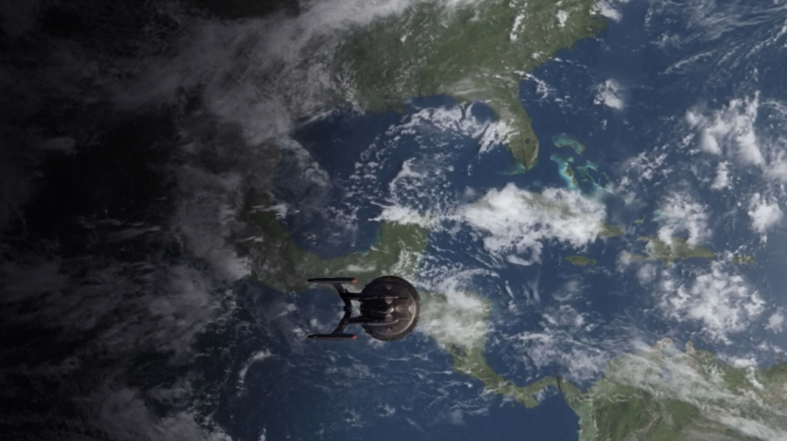
| + | [[File:Gulf of Mexico.jpg|thumb|{{EnterpriseNX}} flies over the Gulf.]] |
||
| − | The '''Gulf of Mexico''' is a major body of water bordered by [[North America]]. |
||
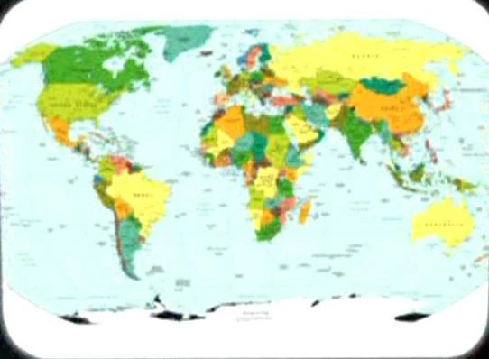
| + | [[File:Earth political map.jpg|thumb|21st century-era political map of the Earth]] |
||
| + | The '''Gulf of Mexico''' was a gulf on [[Earth]]. This was an extension of the [[Atlantic Ocean]], with the [[United States of America]], [[Cuba]], and [[Mexico]] having coastlines on this Gulf. |
||
| + | ''In an [[alternate timeline|alternate]] [[1944]], the gulf itself was labeled on the map of the [[United States of America]] that showed the progress of the [[Nazi]]'s campaign on the [[North America]]n continent. It was described there as '''Golf von Mexico''' ('''Gulf of Mexico''').'' ({{ENT|Storm Front|Storm Front, Part II}}) |
||
| − | The gulf's eastern, north, and northwestern shores lie within the United States of America; its southwestern and southern shores lie within Mexico; and on the southeast it is bordered by Cuba. It connects with the Atlantic Ocean via the Florida Straits between the U.S. and Cuba, and with the Caribbean Sea via the Yucatan Channel between Mexico and Cuba. ([[VOY]]: "[[The 37s (episode)|The 37s]]") |
||
| + | In the [[21st century]], [[Lieutenant]] [[John Kelly]] would tease [[Rose Kumagawa]] about her claim of seening an UFO over the Gulf. He would tell her it was a [[meteor]] or a piece of the [[space station]] ''[[Mir]]''. In one of the last logs of the ''[[Ares IV]]'', Kelly mentioned that he had a remembrance of this. ({{VOY|One Small Step}}) |
||
| − | {{pna}} |
||
| + | |||
| + | In the [[22nd century]], the future [[Commander]] [[Charles Tucker III]] would drive his first car out to [[Chatkin Point]]. He would park at the shoreline, feel the ocean breeze coming off the Gulf, and spend time with his girlfriend staring at the [[Luna|moon]]. ({{ENT|Precious Cargo}}) |
||
| + | |||
| + | Tucker would often go swimming in the Gulf, sometimes inviting a girlfriend named [[Lisa (22nd century)|Lisa]]. He would often tell [[T'Pol]] of his desire to show her some of the beaches of the Gulf. ({{ENT|The Crossing}}) |
||
| + | |||
| + | In [[March (month)|March]] [[2153]], the strait between [[Florida]] and [[Cuba]], which connected the Gulf to the Atlantic, was attacked during the [[Xindi incident]]. ({{ENT|The Expanse}}) |
||
| + | |||
| + | A [[21st century]]-era political map of Earth was stored in the {{USS|Enterprise|NCC-1701}}'s [[USS Enterprise (NCC-1701) library computer|library computer]] in [[2254]]. The location of the Gulf of Mexico was labeled on this map. This map was among the materials viewed by the [[Talosian]]s when they scanned the ''Enterprise'' computer. ({{TOS-R|The Cage}}) |
||
| + | |||
| + | While discussing the prospect of leaving {{USS|Voyager}} to live among a group of [[Human]]s settled in the [[Delta Quadrant]], [[Chakotay]] reminded himself that he could never do it knowing that he would be giving up such prospects as seeing the [[sun]]rise over the [[Arizona]] desert, or swimming in the Gulf of Mexico on a summer's day. ({{VOY|The 37's}}) |
||
| + | |||
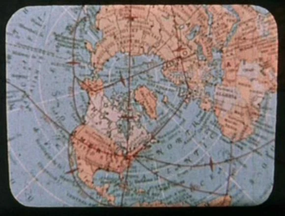
| + | {{bginfo|The map used in the remastered {{e|The Cage}} was a [[Central Intelligence Agency]] map published in September 2008. The ice shelfs of [[Antarctica]] were masked with black ink. [http://www.lib.utexas.edu/maps/world_maps/txu-oclc-264266980-world_pol_2008-2.jpg]|[[File:Earth map, 20th century, Northern Hemisphere.jpg|thumb|[[20th century]] map of the Northern Hemisphere]][[Retroactive continuity]]: The Gulf of Mexico was seen on a [[20th century]]-era map of the northern hemisphere. This map was among the materials viewed by the [[Talosian]]s when they scanned the ''Enterprise'' computer. These maps were from educational texts available at the time of filming, {{y|1964}}. ({{TOS|The Cage}})}} |
||
| + | |||
| + | ==External link== |
||
| + | * {{NCwiki}} |
||
| + | |||
| + | [[fr:Golfe du Mexique]] |
||
| + | [[nl:Golf van Mexico]] |
||
| + | [[Category:Earth bodies of water]] |
||
Revision as of 23:53, 5 February 2015
Enterprise NX-01 flies over the Gulf.
21st century-era political map of the Earth
The Gulf of Mexico was a gulf on Earth. This was an extension of the Atlantic Ocean, with the United States of America, Cuba, and Mexico having coastlines on this Gulf.
In an alternate 1944, the gulf itself was labeled on the map of the United States of America that showed the progress of the Nazi's campaign on the North American continent. It was described there as Golf von Mexico (Gulf of Mexico). (ENT: "Storm Front", "Storm Front, Part II")
In the 21st century, Lieutenant John Kelly would tease Rose Kumagawa about her claim of seening an UFO over the Gulf. He would tell her it was a meteor or a piece of the space station Mir. In one of the last logs of the Ares IV, Kelly mentioned that he had a remembrance of this. (VOY: "One Small Step")
In the 22nd century, the future Commander Charles Tucker III would drive his first car out to Chatkin Point. He would park at the shoreline, feel the ocean breeze coming off the Gulf, and spend time with his girlfriend staring at the moon. (ENT: "Precious Cargo")
Tucker would often go swimming in the Gulf, sometimes inviting a girlfriend named Lisa. He would often tell T'Pol of his desire to show her some of the beaches of the Gulf. (ENT: "The Crossing")
In March 2153, the strait between Florida and Cuba, which connected the Gulf to the Atlantic, was attacked during the Xindi incident. (ENT: "The Expanse")
A 21st century-era political map of Earth was stored in the USS Enterprise's library computer in 2254. The location of the Gulf of Mexico was labeled on this map. This map was among the materials viewed by the Talosians when they scanned the Enterprise computer. (TOS-R: "The Cage")
While discussing the prospect of leaving USS Voyager to live among a group of Humans settled in the Delta Quadrant, Chakotay reminded himself that he could never do it knowing that he would be giving up such prospects as seeing the sunrise over the Arizona desert, or swimming in the Gulf of Mexico on a summer's day. (VOY: "The 37's")
20th century map of the Northern Hemisphere
External link
- Template:NCwiki