(→Mexico: reducing to canon) |
Renegade54 (talk | contribs) m (→Background information: punctuation, spelling, formatting) Tag: sourceedit |
||
| (15 intermediate revisions by 6 users not shown) | |||
| Line 1: | Line 1: | ||
| + | {{at|xx}} |
||
| − | [[File:Earth map.jpg|thumb|North America (upper left) in relation to five of Earth's seven continents]] |
||
| + | [[File: Earth viewed from McKinley Station.jpg|thumb|North America viewed from space, 2378]] |
||
| ⚫ | |||
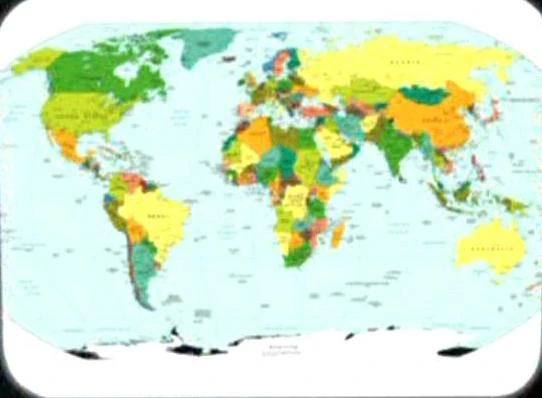
| + | [[File:Earth political map.jpg|thumb|21st century-era political map of Earth]] |
||
| ⚫ | '''North America''' was a [[continent]] on [[Earth]] and, along with neighboring [[South America]], was the ancestral home of the [[Native American]] [[Human]] tribes. This continent contained [[Canada]], [[Mexico]], [[United States of America|United States]], and the [[Central America]]n and [[Caribbean]] nations. The [[Arctic Circle]], a line of latitude, passed through northern North America. The [[Gulf of Mexico]] was located in this continent. This continent had coastlines on the North [[Atlantic Ocean|Atlantic]] and North [[Pacific Ocean]]s. |
||
| + | In the late [[17th century]], the north-western North American continent was unexplored by [[European]] explorers. On their maps, they named this region, "''America Septentrionalis''". (''[[Star Trek: Enterprise]]'', ''opening credits'') |
||
| ⚫ | North America was depicted in many [[assignment patch |
||
| + | ''In an [[alternate timeline|alternate]] [[1944]], [[National Socialist Party|NAZI]] [[Germany]] invaded the continent.'' ({{ENT|Storm Front}}) |
||
| ⚫ | [[ |
||
| ⚫ | |||
| ⚫ | |||
| − | File:Earth_map,_20th_century,_Northern_Hemisphere.jpg|20th century map depicting North America next to the Arctic Circle. |
||
| ⚫ | |||
| − | File:Miri's North America on screen.jpg|A continent resembling North America on a [[Miri's homeworld]] |
||
| ⚫ | |||
| ⚫ | A [[21st century]]-era political map of Earth was stored in the {{USS|Enterprise|NCC-1701}}'s [[USS Enterprise (NCC-1701) library computer|library computer]] in [[2254]]. The North American continent was seen on this map. This map was among the materials viewed by the [[Talosian]]s when they scanned the ''Enterprise'' computer. ({{TOS-R|The Cage}}) |
||
| − | == States and provinces == |
||
| ⚫ | |||
| − | * [[Alberta]] |
||
| − | * [[Manitoba]] |
||
| + | In [[2378]], [[Reginald Barclay]] arranged for [[McKinley Station]] to send an image of the continent to the {{USS|Voyager}} in the [[Delta Quadrant]]. [[Captain]] [[Kathryn Janeway]], appreciating the gesture, thanked Barclay. ({{VOY|Author, Author}}) |
||
| − | === Denmark === |
||
| ⚫ | |||
| ⚫ | |||
| ⚫ | |||
| − | {{US states|noexternal}} |
||
| − | == Cities == |
||
| − | === Canada === |
||
| − | * [[Calgary]] |
||
| − | * Toronto ([[Toronto City Hall]]) |
||
| − | + | == Appendices == |
|
| + | === Background information === |
||
| − | * [[Cancun]] |
||
| + | One of the 17th century maps, known as "Harmonia macrocosmica seu atlas universalis et novus, totius universi creati cosmographiam generalem, et novam exhibens", was created by {{w|Andreas Cellarius}}. A scan of the original can be found [http://commons.wikimedia.org/wiki/File:Cellarius_Harmonia_Macrocosmica_-_Situs_Terrae_Circulis_coelestibus_Circundatae.jpg here]. |
||
| − | * [[Acapulco]] |
||
| + | The maps used in the original {{e|The Cage}} were published in the early 1960s. The landmasses of North and Central America, and the Caribbean Islands, were seen on two political maps of the northern hemisphere. Decades later, the map used in the remastered "The Cage" was a Central Intelligence Agency map published either in April 2007 or September 2008. [http://www.lib.utexas.edu/maps/world_maps/world_pol_2007.pdf] [http://www.lib.utexas.edu/maps/world_maps/world_pol_2008.pdf] The difference, which was not noticeable at the resolution of the image from the episode, was the addition of Kosovo, which gained its independence between the releases. |
||
| − | === United States === |
||
| − | {{USCities}} |
||
| ⚫ | |||
| ⚫ | |||
| + | File:Earth map, 20th century, Northern Hemisphere.jpg|20th century-era political map of Earth |
||
| ⚫ | |||
| ⚫ | |||
| ⚫ | |||
| ⚫ | |||
| + | {| class="grey" width=100% |
||
| + | |- |
||
| + | ! colspan="3" style="text-align:center" | Features from the CIA map |
||
| + | |- |
||
| + | ! style="width:5%" | Country |
||
| + | ! style="width:5%" | Capital |
||
| + | ! style="width:10%" | Notes |
||
| + | |- |
||
| + | |Anguilla |
||
| + | | |
||
| + | |A Caribbean territory of the United Kingdom |
||
| + | |- |
||
| + | |Antigua and Barbuda |
||
| + | | |
||
| + | |A Caribbean country. |
||
| + | |- |
||
| + | |Aruba |
||
| + | | |
||
| + | |A Caribbean territory of the Netherlands |
||
| + | |- |
||
| + | |Bahamas |
||
| + | |Nassau |
||
| + | |A Caribbean country |
||
| + | |- |
||
| + | |Belize |
||
| + | |Belmopan |
||
| + | |A Central American country |
||
| + | |- |
||
| + | |Barbados |
||
| + | | |
||
| + | |A Caribbean country |
||
| + | |- |
||
| + | |Bermuda |
||
| + | | |
||
| + | |A North Atlantic Ocean territory of the United Kingdom |
||
| + | |- |
||
| + | |British Virgin Islands |
||
| + | | |
||
| + | |A Caribbean territory of the United Kingdom |
||
| + | |- |
||
| ⚫ | |||
| + | |Ottawa |
||
| + | |A Northern American country. Major cities - Calgary, Churchill, Edmonton, Fort McMurray, Halifax, Happy Valley - Goose Bay, Iqaluit, Kuujjuag, Montreal, Pond Inlet, Prince George, Québec, Resolute, Saskatoon, Toronto, Vancouver, Whitehourse, Winnipeg |
||
| + | |- |
||
| + | |Cayman Islands |
||
| + | | |
||
| + | |A Caribbean territory of the United Kingdom |
||
| + | |- |
||
| + | |Clipperton Island |
||
| + | | |
||
| + | |A North Pacific Ocean territory of France |
||
| + | |- |
||
| + | |Costa Rica |
||
| + | |San José |
||
| + | |A Central American country |
||
| + | |- |
||
| + | |Cuba |
||
| + | |Havana |
||
| + | |A Caribbean country |
||
| + | |- |
||
| + | |Dominica |
||
| + | | |
||
| + | |A Caribbean country |
||
| + | |- |
||
| + | |Dominican Republic |
||
| + | |Santo Domingo |
||
| + | |A Caribbean country. Major city - Santiago |
||
| + | |- |
||
| + | |El Salvador |
||
| + | |San Salvador |
||
| + | |A Central American country. |
||
| + | |- |
||
| ⚫ | |||
| + | |Nuuk (Godthåb) |
||
| + | |A territory of Denmark, between the Arctic Ocean and the North Atlantic Ocean. Major city - Qaanaaq (Thule) |
||
| + | |- |
||
| + | |Grenada |
||
| + | | |
||
| + | |A Caribbean country. |
||
| + | |- |
||
| + | |Guadeloupe |
||
| + | | |
||
| + | |A Caribbean territory of France |
||
| + | |- |
||
| + | |Guatemala |
||
| + | |Guatemala |
||
| + | |A Central American country |
||
| + | |- |
||
| + | |Haiti |
||
| + | |Port-au-Prince |
||
| + | |A Caribbean country |
||
| + | |- |
||
| + | |Honduras |
||
| + | |Tegucigalpa |
||
| + | |A Central American country |
||
| + | |- |
||
| + | |Jamaica |
||
| + | |Kingston |
||
| + | |A Caribbean country |
||
| + | |- |
||
| + | |Martinique |
||
| + | | |
||
| + | |A Caribbean territory of France |
||
| + | |- |
||
| + | |Mexico |
||
| + | |Mexico City |
||
| + | |A Northern American country. Major cities - Acapulco, Cancún, Ciudad Juarez, Guadalajara, León, Matamoros, Mérida, Mexicali, Monterery, Oaxaca, Puebla, San Luis Potosí, Tijuana, Toluca, Torreón |
||
| + | |- |
||
| + | |Montserrat |
||
| + | | |
||
| + | |A Caribbean territory of the United Kingdom |
||
| + | |- |
||
| + | |Navassa Island |
||
| + | | |
||
| + | |A Caribbean territory of the United States |
||
| + | |- |
||
| + | |Netherlands Antilles |
||
| + | | |
||
| + | |A Caribbean territory of the Netherlands |
||
| + | |- |
||
| + | |Nicaragua |
||
| + | |Managua |
||
| + | |A Central American country. |
||
| + | |- |
||
| + | |Panama |
||
| + | |Panama |
||
| + | |A Central American country. Major city - Colón |
||
| + | |- |
||
| + | |Puerto Rico |
||
| + | |San Juan |
||
| + | |A Caribbean territory of the United States |
||
| + | |- |
||
| + | |Saint Kitts and Nevis |
||
| + | | |
||
| + | |A Caribbean country |
||
| + | |- |
||
| + | |Saint Lucia |
||
| + | | |
||
| + | |A Caribbean country |
||
| + | |- |
||
| + | |Saint Pierre and Miquelon |
||
| + | | |
||
| + | |A North Atlantic Ocean territory of France |
||
| + | |- |
||
| + | |Saint Vincent and the Grenadines |
||
| + | | |
||
| + | |A Caribbean country |
||
| + | |- |
||
| + | |Trinidad and Tobago |
||
| + | |Port of Spain |
||
| + | |A Caribbean country |
||
| + | |- |
||
| + | |Turks and Caicos Islands |
||
| + | | |
||
| + | |A Caribbean territory of the United Kingdom |
||
| + | |- |
||
| ⚫ | |||
| + | |Washington, DC |
||
| + | |A Northern American country. Major cities - Anchorage, Atlanta, Austin, Baltimore, Barrow, Boston, Buffalo, Charlotte, Chicago, Cincinnati, Cleveland, Dallas, Denver, Detroit, El Paso, Fairbanks, Honolulu, Houston, Indianapolis, Jacksonville, Juneau, Kansas City, Las Vegas, Miami, Milwaukee, Minneapolis, Nashville, New Orleans, New York, Nome, Norfolk, Oklahoma, Orlando, Phoenix, Philadelphia, Pittsburgh, Portland, Providence, Sacramento, Salt Lake City, San Antonio, San Francisco, San Diego, Seattle, Tampa |
||
| + | |} |
||
| ⚫ | |||
| ⚫ | |||
| ⚫ | |||
[[de:Nordamerika]] |
[[de:Nordamerika]] |
||
| Line 45: | Line 195: | ||
[[it:Nord America]] |
[[it:Nord America]] |
||
[[nl:Noord Amerika]] |
[[nl:Noord Amerika]] |
||
| ⚫ | |||
Revision as of 16:36, 1 May 2015
AT: "xx"

North America viewed from space, 2378
21st century-era political map of Earth
North America was a continent on Earth and, along with neighboring South America, was the ancestral home of the Native American Human tribes. This continent contained Canada, Mexico, United States, and the Central American and Caribbean nations. The Arctic Circle, a line of latitude, passed through northern North America. The Gulf of Mexico was located in this continent. This continent had coastlines on the North Atlantic and North Pacific Oceans.
In the late 17th century, the north-western North American continent was unexplored by European explorers. On their maps, they named this region, "America Septentrionalis". (Star Trek: Enterprise, opening credits)
In an alternate 1944, NAZI Germany invaded the continent. (ENT: "Storm Front")
North America was depicted in many assignment patches of NASA's space programs, especially for the Apollo program and Space shuttle program, in the 20th and 21st centuries. Copies of these patches were displayed at the 602 Club. (ENT: "First Flight")
A 21st century-era political map of Earth was stored in the USS Enterprise's library computer in 2254. The North American continent was seen on this map. This map was among the materials viewed by the Talosians when they scanned the Enterprise computer. (TOS-R: "The Cage")
In 2378, Reginald Barclay arranged for McKinley Station to send an image of the continent to the USS Voyager in the Delta Quadrant. Captain Kathryn Janeway, appreciating the gesture, thanked Barclay. (VOY: "Author, Author")
| Continents of Earth |
|---|
| Africa • Antarctica • Asia • Australia • Europe • North America • South America |
Appendices
Background information
One of the 17th century maps, known as "Harmonia macrocosmica seu atlas universalis et novus, totius universi creati cosmographiam generalem, et novam exhibens", was created by Andreas Cellarius. A scan of the original can be found here.
The maps used in the original "The Cage" were published in the early 1960s. The landmasses of North and Central America, and the Caribbean Islands, were seen on two political maps of the northern hemisphere. Decades later, the map used in the remastered "The Cage" was a Central Intelligence Agency map published either in April 2007 or September 2008. [1] [2] The difference, which was not noticeable at the resolution of the image from the episode, was the addition of Kosovo, which gained its independence between the releases.
")
")
| Features from the CIA map | ||
|---|---|---|
| Country | Capital | Notes |
| Anguilla | A Caribbean territory of the United Kingdom | |
| Antigua and Barbuda | A Caribbean country. | |
| Aruba | A Caribbean territory of the Netherlands | |
| Bahamas | Nassau | A Caribbean country |
| Belize | Belmopan | A Central American country |
| Barbados | A Caribbean country | |
| Bermuda | A North Atlantic Ocean territory of the United Kingdom | |
| British Virgin Islands | A Caribbean territory of the United Kingdom | |
| Canada | Ottawa | A Northern American country. Major cities - Calgary, Churchill, Edmonton, Fort McMurray, Halifax, Happy Valley - Goose Bay, Iqaluit, Kuujjuag, Montreal, Pond Inlet, Prince George, Québec, Resolute, Saskatoon, Toronto, Vancouver, Whitehourse, Winnipeg |
| Cayman Islands | A Caribbean territory of the United Kingdom | |
| Clipperton Island | A North Pacific Ocean territory of France | |
| Costa Rica | San José | A Central American country |
| Cuba | Havana | A Caribbean country |
| Dominica | A Caribbean country | |
| Dominican Republic | Santo Domingo | A Caribbean country. Major city - Santiago |
| El Salvador | San Salvador | A Central American country. |
| Greenland | Nuuk (Godthåb) | A territory of Denmark, between the Arctic Ocean and the North Atlantic Ocean. Major city - Qaanaaq (Thule) |
| Grenada | A Caribbean country. | |
| Guadeloupe | A Caribbean territory of France | |
| Guatemala | Guatemala | A Central American country |
| Haiti | Port-au-Prince | A Caribbean country |
| Honduras | Tegucigalpa | A Central American country |
| Jamaica | Kingston | A Caribbean country |
| Martinique | A Caribbean territory of France | |
| Mexico | Mexico City | A Northern American country. Major cities - Acapulco, Cancún, Ciudad Juarez, Guadalajara, León, Matamoros, Mérida, Mexicali, Monterery, Oaxaca, Puebla, San Luis Potosí, Tijuana, Toluca, Torreón |
| Montserrat | A Caribbean territory of the United Kingdom | |
| Navassa Island | A Caribbean territory of the United States | |
| Netherlands Antilles | A Caribbean territory of the Netherlands | |
| Nicaragua | Managua | A Central American country. |
| Panama | Panama | A Central American country. Major city - Colón |
| Puerto Rico | San Juan | A Caribbean territory of the United States |
| Saint Kitts and Nevis | A Caribbean country | |
| Saint Lucia | A Caribbean country | |
| Saint Pierre and Miquelon | A North Atlantic Ocean territory of France | |
| Saint Vincent and the Grenadines | A Caribbean country | |
| Trinidad and Tobago | Port of Spain | A Caribbean country |
| Turks and Caicos Islands | A Caribbean territory of the United Kingdom | |
| United States | Washington, DC | A Northern American country. Major cities - Anchorage, Atlanta, Austin, Baltimore, Barrow, Boston, Buffalo, Charlotte, Chicago, Cincinnati, Cleveland, Dallas, Denver, Detroit, El Paso, Fairbanks, Honolulu, Houston, Indianapolis, Jacksonville, Juneau, Kansas City, Las Vegas, Miami, Milwaukee, Minneapolis, Nashville, New Orleans, New York, Nome, Norfolk, Oklahoma, Orlando, Phoenix, Philadelphia, Pittsburgh, Portland, Providence, Sacramento, Salt Lake City, San Antonio, San Francisco, San Diego, Seattle, Tampa |